See What Your Phone's GPS Chip is
Really Saying to Space
Ever wondered how fast your plane is flying at 35,000 feet, or which satellites are above your head right now? Vectosat reads raw signals straight from space, no internet required.
How Vectosat Works
Understanding GPS technology has never been this simple.
Satellites in Space 🛰️
Dozens of navigation satellites (GPS, Galileo, GLONASS, BeiDou) float 20,000 km above Earth, constantly beaming location signals down to us.
Your Phone's Receiver 📱
Your phone's internal GPS chip picks up these signals directly from the sky, without needing cell towers or WiFi, and turns them into lines of text called NMEA sentences.
Vectosat Magic 📊
Vectosat translates those raw sentences into clean speedometer cards, live satellite radar maps, and downloadable route tracks in real time.
See It In Action
Real screens from a real device — no mockups.
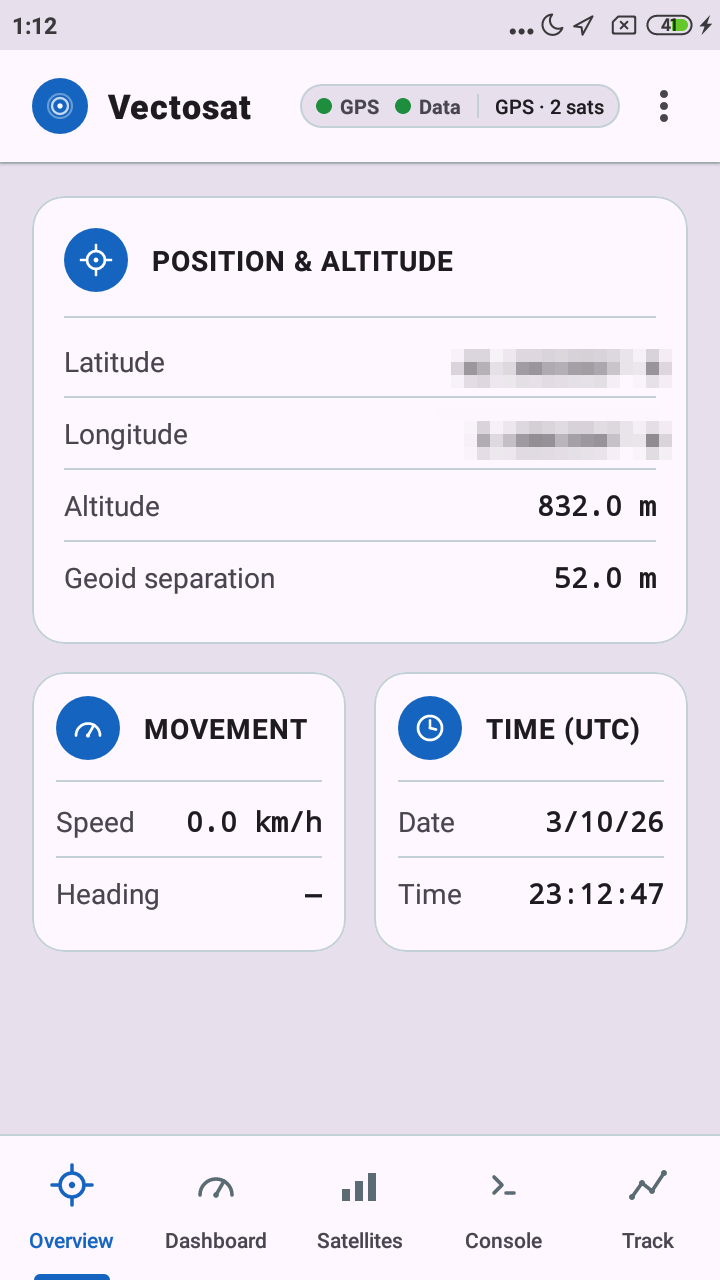
Overview
Every core reading in one place, straight from the satellites.
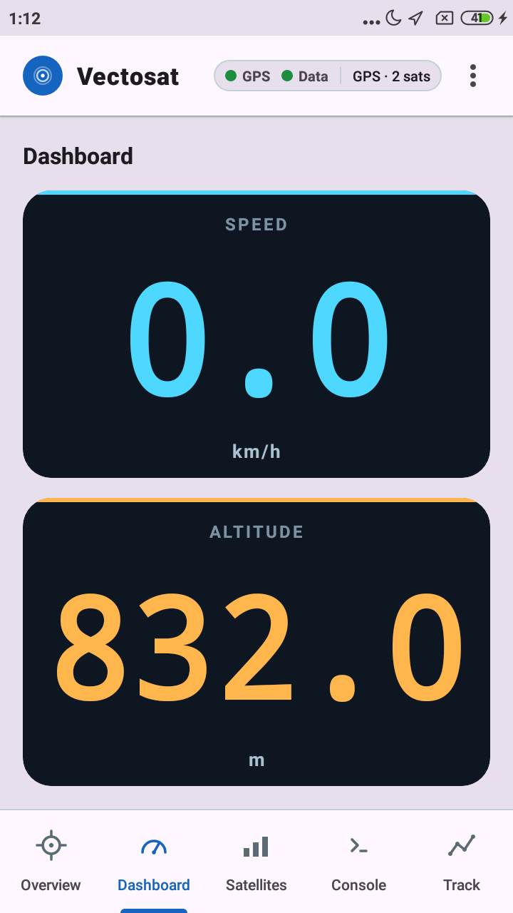
Dashboard
A glanceable, high-visibility HUD built for the car, bike, or boat.
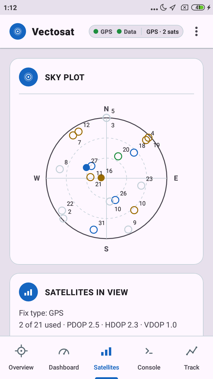
Satellites
A live polar sky radar, color-coded by constellation: GPS, GLONASS, Galileo, BeiDou.
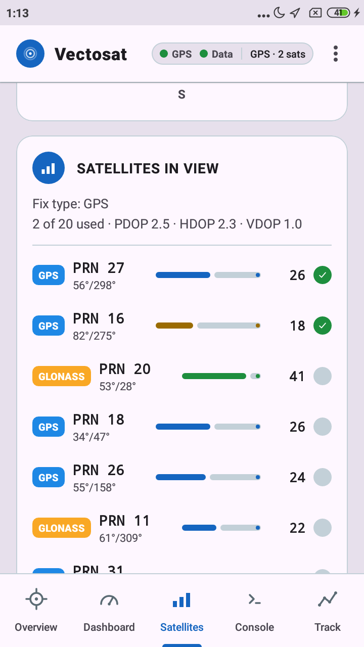
Satellite List
Every satellite tagged by constellation, with live signal strength and fix status.
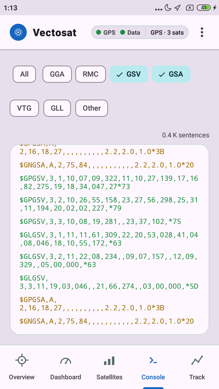
Console
The raw NMEA feed, decoded and color-coded by sentence type.
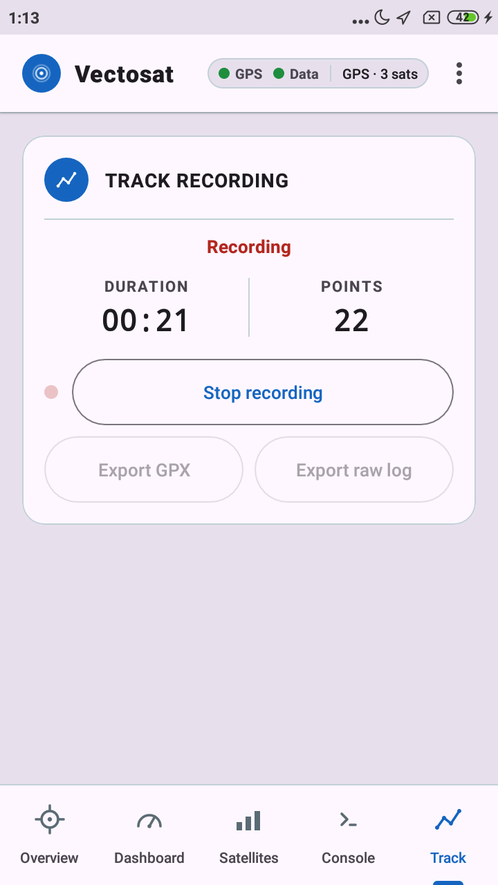
Track Recording
Record a route live, then export it as GPX or a raw NMEA log.
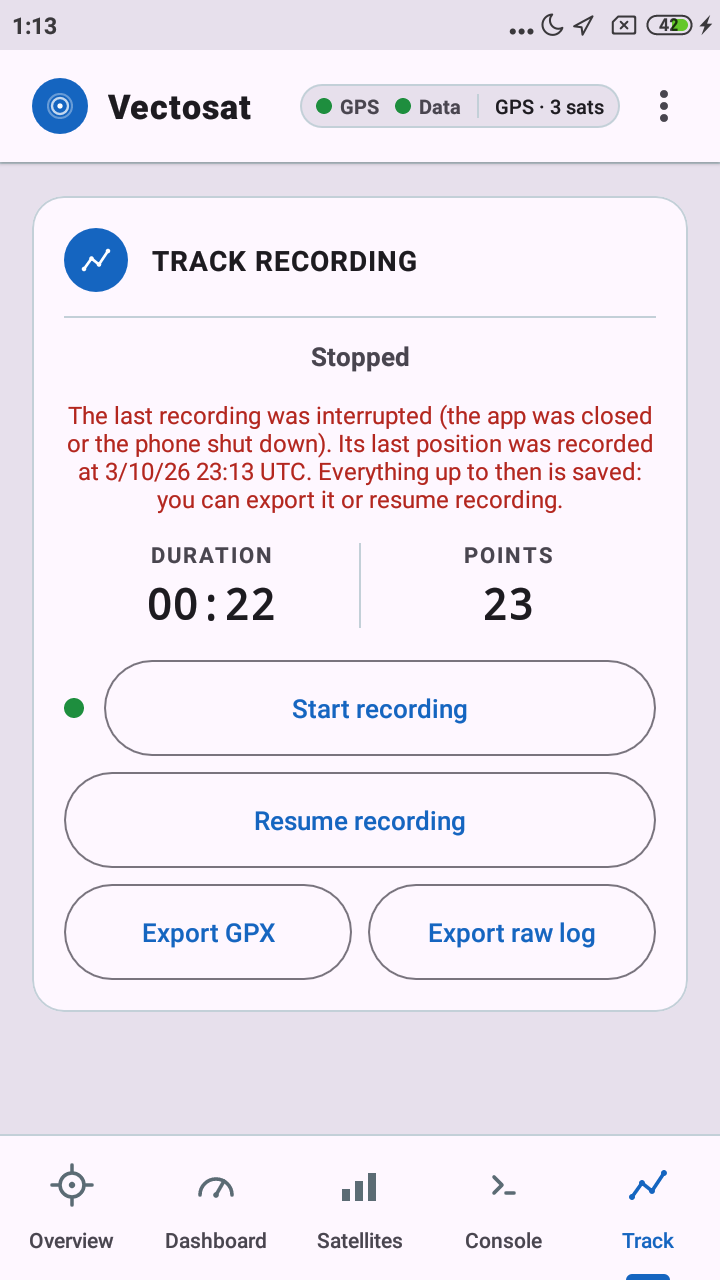
Interrupted? Pick Up Where You Left Off
If Android closes the app mid-recording, the track is recovered: export it or resume it.
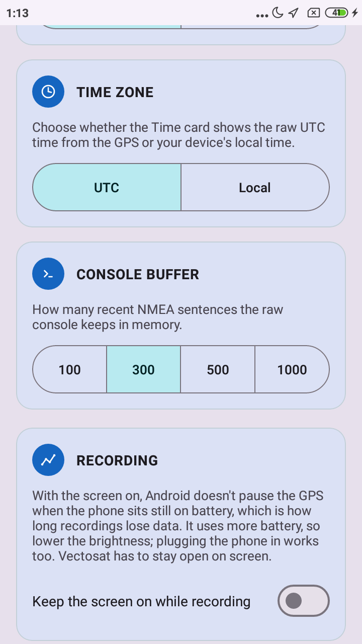
Settings
Units, time zone, console size, and an option to keep the screen on during long recordings.
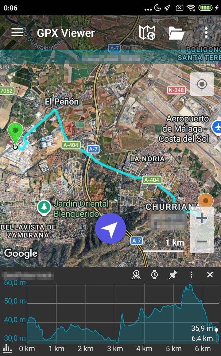
Export, Then Go Anywhere
A real drive recorded with Vectosat, opened straight up in a third-party GPX viewer app.
"GPX Viewer" shown above is a third-party app, used here only to show the exported file opening correctly. Not affiliated with or endorsed by Vectosat. Coordinates in the screenshots are blurred.
Fascinating Real-World Use Cases
Built for curious travelers, outdoor adventurers, and tech enthusiasts.
In-Flight Flight Tracker
On a long airplane flight with no internet? Place your phone near the window with the app open. Vectosat can lock onto satellites through the airplane window, showing your speed, altitude, and route live. You can then export your track to view your journey after landing.
Works in Airplane Mode →Mountain & Wilderness Hikes
Exploring remote trails with zero cell coverage? Vectosat works offline. See exact coordinates, monitor elevation gains, and record your route as a GPX file.
No Data Required →Big Dashboard Speedometer
Mount your phone on your car dashboard, bicycle, or boat. Vectosat features a high-visibility, large-font dashboard engineered to give glanceable speed and altitude readings at a single look.
Glanceable UI →Space Satellite Inspector
Ever wanted to know which satellites are hovering above your roof right now? View a live 360° sky plot showing active satellite numbers, constellations, and signal strength (SNR).
Live Space Radar →Packed with Powerful Features
Everything you need to inspect, record, and understand your location.
Live Overview
Instant access to position coordinates, altitude, speed, heading, and the date and time, formatted to your preferred units (metric or imperial).
Glanceable Dashboard
Designed for vehicle mounts. Extra-large numbers display current speed and altitude so you can check your metrics at a glance.
Polar Satellite Sky Plot
A sky map displaying constellations (GPS, Galileo, GLONASS, BeiDou) with elevation, azimuth, signal-to-noise ratio (SNR), and fix status.
Track Recorder & GPX Export
Record your journeys, flights, or hikes, even with the screen off or another app in front. Then export a GPX track or the raw NMEA log to open in Google Earth, Strava, or GIS tools.
Keeps Recording in the Background
A notification shows while a recording runs, so it carries on with the screen off. If the GPS goes silent mid-recording, Vectosat tells you and reconnects by itself.
Recovers Interrupted Recordings
Positions and raw sentences are written to disk as they arrive. If Android closes the app or the phone dies, the track is recovered next time and you can export it or resume it.
Raw NMEA Console
Inspect every single sentence ($GPGGA, $GPRMC, $GPGSV) as it arrives straight from your phone's hardware with color coding and filter controls.
Offline & Private
Vectosat does not ask for internet permission. It has no tracking servers, no ad networks and no analytics, and the app never sends your location anywhere.
Built with Privacy in Mind
No corporate tracking, no annoying ads, no hidden surprises.
No Internet Permission
The app doesn't declare the internet permission, so it has no way to connect to the network.
No Ads & No Analytics
No SDKs, no trackers, no Google Analytics, no login accounts. Just pure software.
Location Only When You Use It
Vectosat reads your location while the app is open, or while you record a track, with a notification showing. It never asks for background location permission.
Free, With No Ads
Vectosat is a free app with no advertising. I built it out of passion for clean software, satellite tech, and outdoor exploration.
Frequently Asked Questions
Everything you need to know about Vectosat.
Does Vectosat work in Airplane Mode on a flight?
Yes, technically. Your phone's GPS receiver operates independently from cellular and WiFi antennas, so with the app open near an airplane window it can usually lock onto satellites and show your live speed, altitude, and location. Check your airline's rules on using GPS devices first, and note that reception inside a plane varies.
What is an NMEA sentence?
NMEA 0183 is the standard text-based language used by GPS hardware around the world. Every line (like $GPRMC or $GPGGA) contains raw data about coordinates, satellite count, timestamp, and signal quality.
Why is Vectosat free and ad-free?
I created Vectosat as an independent Android developer who wanted a transparent, bloat-free tool to see what GPS chips are doing, without ads or data collection.
How do I view my recorded GPX flight or hike tracks?
When you export your track as a GPX file, you can open it in free software like Google Earth, Strava, Garmin Connect, or any online GPX viewer to see your 3D altitude profile and map route.
Does recording keep working with the screen off?
Yes. While you record, Vectosat runs as an Android foreground service, shown by a notification, so it keeps going with the screen off or while you use other apps. One limit comes from Android itself: if the phone sits still, unplugged, with the screen off for a couple of hours, Android's Doze mode can pause the GPS for every app. Some phones (Samsung, Xiaomi, Huawei, OnePlus…) also cut GPS updates sooner for apps restricted by their battery settings: when you start a recording, Vectosat offers to take you to those settings so you can set it to "Unrestricted". Vectosat notices when the GPS goes silent, warns you in its notification and tries to reconnect. For a long recording at rest, keep the phone plugged in, or turn on "Keep the screen on while recording" in Settings.
What if the app closes or the phone shuts down while I'm recording?
Positions and raw sentences are written to disk as they arrive, so very little is lost. The next time you open Vectosat, the Track tab tells you the recording was interrupted and when its last position was recorded. You can export what was saved, or resume the recording.
Why does Vectosat ask for precise location?
The raw GPS data (satellites, NMEA sentences) is only available with precise location. On Android 12 and later you can grant approximate location instead, but then Vectosat has nothing to show, so it asks for precise.
Ready to Explore the Sky Above You?
Download Vectosat for free and take control of your device's GPS hardware.